Access and highways
Vehicular access to the proposed development will be taken from new roundabout junctions on Stone Road on the northern side of the site and Stafford Road to the south, with a spine road through the development linking the two. It is proposed that speed limits along both Stone Road and Stafford Road will be reduced to 30mph as part of the access proposals, with appropriate access designs to suit.
The sustainable location of the site facilitates easy access to Eccleshall town centre on foot or by bike, boosting footfall to local businesses. Providing a new school and surgery within the development will also reduce dependence on the motorcar.
Potential improvements to wider connectivity is being explored, including improvements to walking and cycling connections to the town centre, and improvements to bus services.
There is an existing public right of way (Eccleshall 17) running centrally through the site from west to east. There are opportunities to enhance this right of way as “Eccleshall Greenway”, improving accessibility and providing connectivity into the extensive public open spaces and network of walking routes proposed within the site.
The planning application will be informed by extensive technical studies, including a robust Transport Assessment. This report will assess the highway safety and capacity of the surrounding highway network to ensure that the development can be safely accommodated.
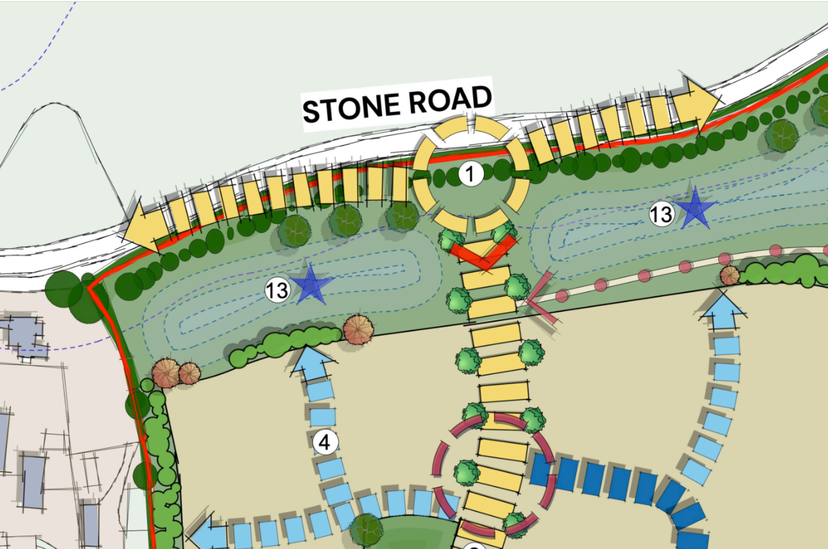
Vehicular access will be taken from new roundabout junctions on Stone Road on the northern side of the site and Stafford Road to the south, with a spine road through the development linking the two - click to enlarge
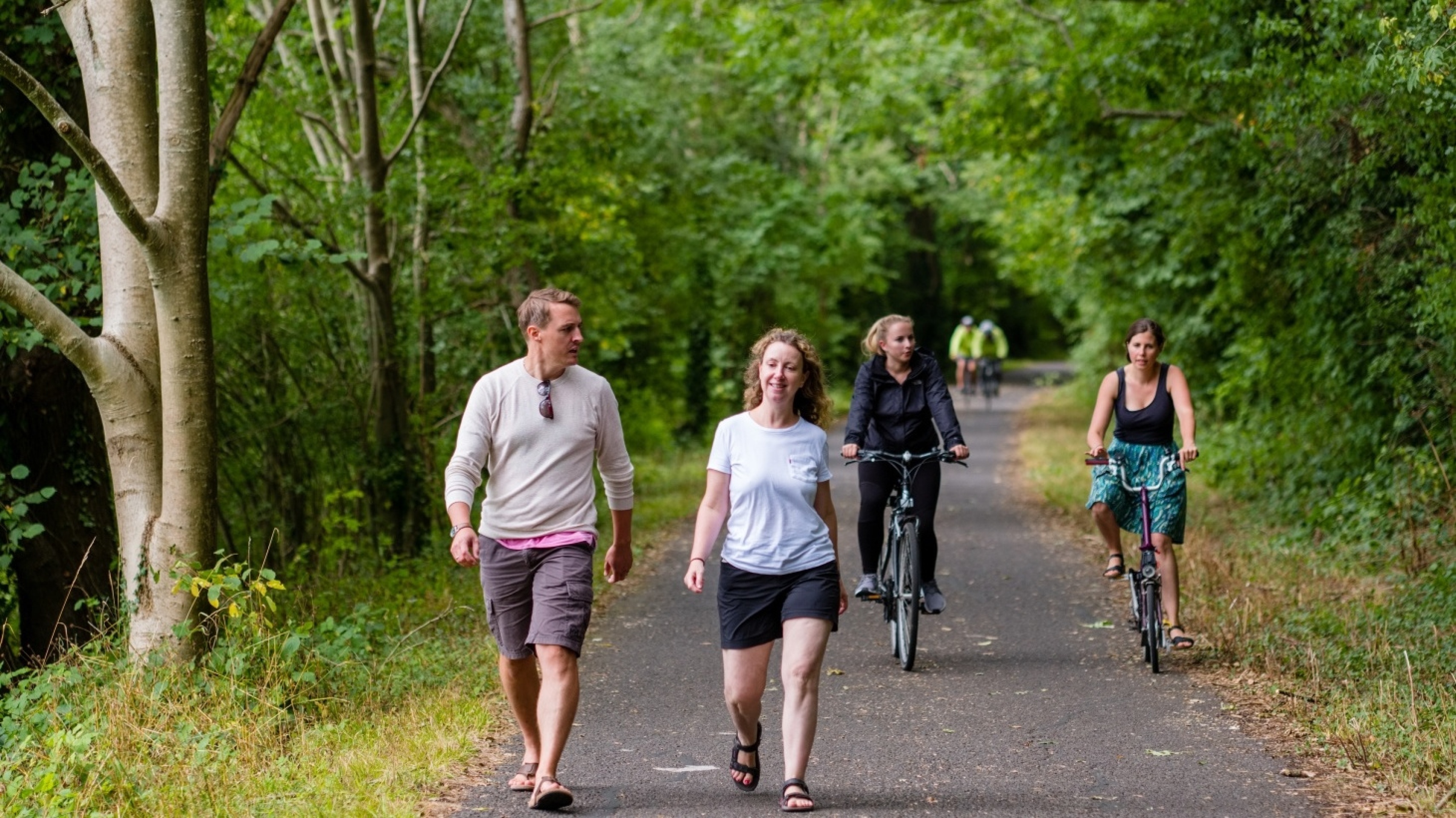
Existing public right of way within the site will be retained and enhanced alongside the provision of a new network of walking and cycling routes. Walking and cycling provision between the site and the town centre will also be enhanced, as well as potential improvements to bus services.
Drainage
The site is located within Flood Zone 1 of the Environment Agency’s flood map for planning. This means it is considered to be at the lowest risk of fluvial flooding. However, we are conscious of concerns around flood risk in Eccleshall more widely. We have appointed specialist consultants to design a sustainable drainage system to support the proposed development while identifying opportunities to improve drainage in the surrounding area.
The Environment Agency’s map suggests localised spots of surface water flooding on the site, the proposals will incorporate a sustainable drainage system (SUDS) that will manage surface water drainage, delivering betterment to the current situation, in addition to providing habitat enhancement through the creation of wetland features.

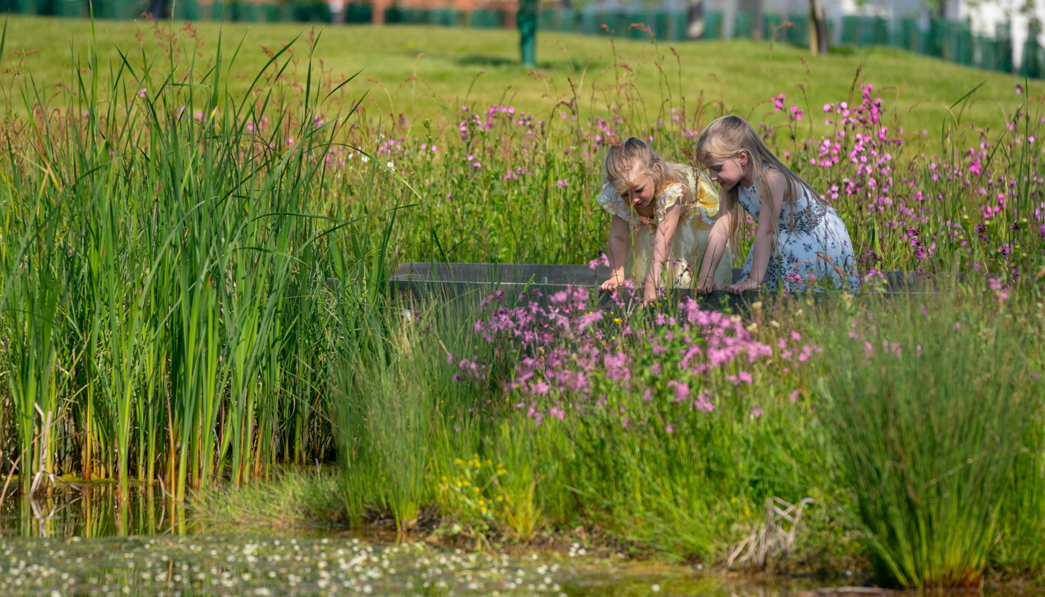
The Sustainable Drainage System will deliver habitat and biodiversity enhancements, in addition to managing surface water.
Other technical considerations
Studies are being carried out and reports prepared on a range of other technical matters, including:
- Ecology
- Utilities
- Noise
- Heritage
- Air Quality
- Lighting
- Arboriculture